Article Title :
Multi-criteria Prioritization for Sub-watersheds in Medium River Basin using AHP and Influence Approaches
2 (2018)
61-82
Influence , Weights , AHP , Correlation matrix , Multi-criteria analysis , Ranking , Prioritization


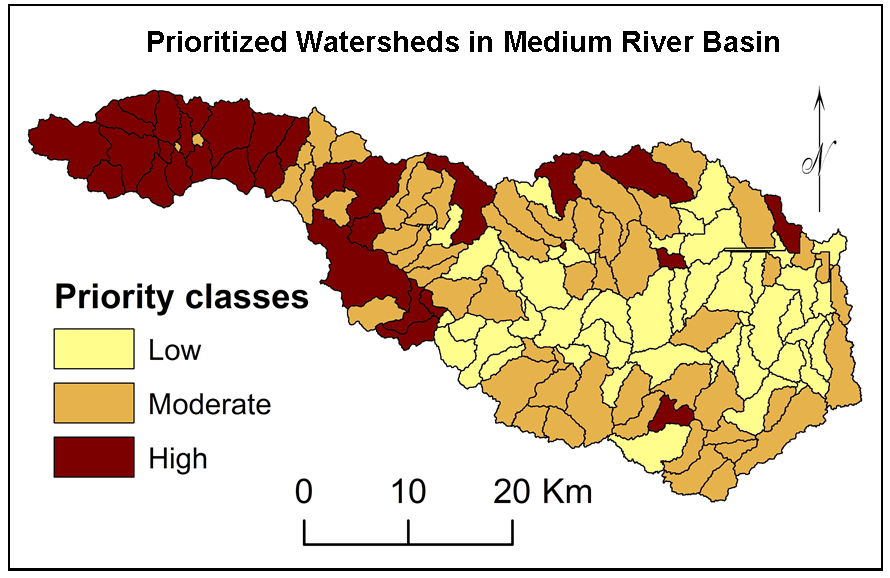
Watershed is unique bio-physical unit of the Earth surface and source of resources to the human, animal and plants. AHP based multi-criteria analysis is suitable for prioritization of sub-watersheds in medium river basin for planning, management and development. Twenty five criterion i.e. area,\(P\), \(D_d\), \(T\), \(L_b \), \(R_c\), \(C_C\), \(R_f\), \(R_e\), \(L_u\), \(N_u\), \(F_s\), \(L_{sm}\), \(R_{L}\), \(R_b\), \(R_t\), \(B_s\), \(I_f\), \(R_{h1}\), \(R_n\) geology, slope, soil, rainfall and population density were selected for prioritization of medium watersheds of Upper Mula basin in Maharashtra (India). Correlation analysis is suitable for ranking the criterion selected for prioritization. Texture Ratio (25.94%), drainage texture (12.97%), stream order (8.65%), total stream length (6.49%) and ruggedness number (5.19%) show higher influences on development of watershed structure in the study area. Further, criterion like geology, rainfall, soil and population were show considerable influence in prioritization of sub-watersheds in medium river basin. Influences were estimated based on weights calculated using AHP technique. Values of influences were normalized using distribution of particular criterion within sub-watersheds. Watersheds are classified into high, moderate and low priorities. The methodology formulated in this study can be effective tool for quick prioritization of medium and major watersheds for planning and management for development.
Multi-criteria analysis using AHP technique with normalized influences is useful for watershed prioritization for management and development.
Morphometric, physiographic and demographic (25) criterion were used for prioritization.
Correlation analysis is useful for robust judgment of ranks.
Weights estimated using AHP technique were used for calculations of influences.
Calculated influences were normalized based on spatial distribution of selected criterion.
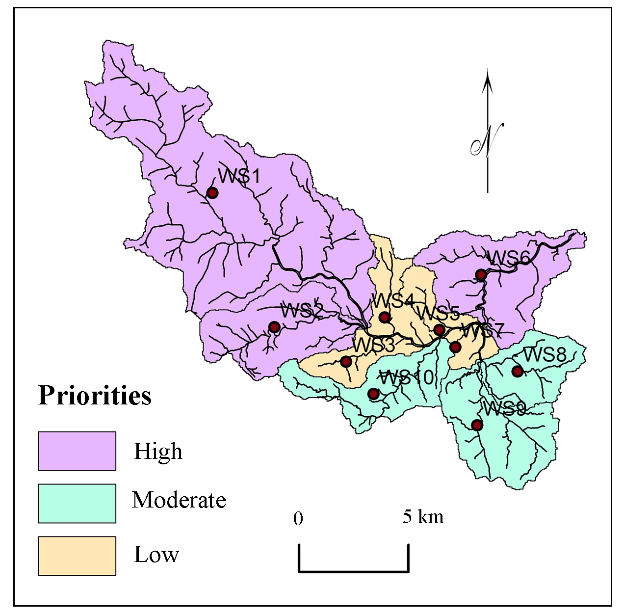
Sub-watersheds in the basin were classified into high, moderate and low priorities.
Distribution of rainfall, soils and population show importance in prioritization of sub-watersheds in medium river basins.
The methodology used for present study can be useful tool for rapid prioritization of watersheds.
Bodas, M. S., Khadri, S. F. R. and Subbarao K. V., 1988. Stratigraphy of the Jawhar and Igatpuri formations, Western Deccan Province. In: Subbarao, K. V., (Ed) Deccan Flood Basalts. Mem. Geol. Soc. Ind., 10, 235-252.
Duraiswami, R. A., 2005. Dykes as potential groundwater reservoirs in semi-arid areas of Sakri Taluka, district Dhule of Maharashtra. Gond. Geol. Mag., 20(1), 1-9.
Gajbhiye, S, Sharma, S. K. and Meshram, C., 2014. Prioritization of watershed through sediment yield index using RS and GIS approach. International Journal of u- and e- Service, Science and Technology, 7(6), 47-60.
Kaur, M., Singh, S., Verma, V. K. and Pateriya, B., 2014. Quantitative geomorphological analysis and land use/ land cover change detection of two sub-watersheds in ne region of Punjab, India. International Archives of the Photogrammetry, Remote Sensing and Spatial Information Sciences - ISPRS Archives, XL-8(1), 371-375.
Kaur, M., Singh, S., Verma, V. K. and Pateriya, B., 2014. Quantitative geomorphological analysis and land use/ land cover change detection of two sub-watersheds in Ne Region of Punjab, India. The International Archives of the Photogrammetry, Remote Sensing and Spatial Information Sciences, 49(8), 371-375.
Kedareswarudu, U., Aravind, U. S. and Chattopadhyay, M., 2013. Analysis of watershed characteristics and basin management using RS and GIS: A case study from upper Provenance of Karamana river, Trivendrum district, Kerala. International Journal of Remote Sensing and Geoscience (IJRSG), 2(1), 36-48.
Khadri, S. F. R., Subbarao, K. V., Hooper, P. R. and Walsh, J. N., 1988. Stratigraphy of Thakurwadi Formation, Western Deccan basaltic Province, India. In: Subbarao, K. V., (Ed) Deccan Flood Basalts. Mem. Geol. Soc. Ind., 10, 281-304.
Kulkarni, R. N., 1990. Dykes as underground dams (Bandharas), groundwater conservation structure. In: Proc. of ‘All India seminar on modern techniques of rainwater harvesting, conservation, and artificial recharge for drinking water, afforestration, horticulture and agriculture’, 347-349.
Mahoney, J. J., Macdougall, J. D., Lugmair, G. W., Gopalan, K. and Krishnamurthy, P., 2000. Origin of contemporaneous tholeiitic and K-rich alkalic lavas: a case study from the northern Deccan Plateau, India. Earth and Planetary Sci Let, 73, 39-53.
Melluso, L., Beccaluva, L., Brotzu, P., Gregnanin, A., Gupta, A. K., Morbidelli, L. and Traversa, G., 1995. Constraints on the mantle sources of the deccan traps from the petrology and geochemistry of the basalts of Gujarat State (Western India). Jour Petrology, 36(5), 1393-1432.
Nagal, S., Tignath, S. and Pandey, A., 2014. Morphometric analysis of the Adwa River Basin, tributary of Belan River, India. International Journal of Advanced Technology and Engineering Research, 4(2), 39-45.
Panhalkar, S., 2011. Land capability classification for integrated watershed development by applying Remote Sensing and GIS techniques. ARPN Journal of Agricultural and Biological Science, 6(4), 46-55.
Pawar, J. B., 2007. Hydrogeology of Upper Panjhara Basin with special reference to role of dykes in the occurrence and movement of groundwater, district Dhule, Maharashtra. Unpublished Ph.D. thesis, University of Pune.
Pawar, N. J., Pawar, J. B., Supekar, A., Karmalkar, N. R. and Kumar, S., Erram, V., 2008. Deccan Dykes as discrete and prospective aquifers in parts of Narmada-Tapi zone, Dhule district, Maharashtra. In: Indian Dykes: Geochemistry, Geophysics and Geochronology, Narosa Pub, New Delhi, India.
Powar, K. B., 1987. Evolution of the Deccan Volcanic Province. Presidential Address (74th ession) Geol and Geog Section, Ind. Sci. Cong., 29.
Rai, P. K., Mohan, K., Mishra, S., Ahmad, A. and Mishra, V. N., 2014. A GIS-based approach in drainage morphometric analysis of Kanhar River Basin, India. Appl.Water Sci., 7(1), 217-232.
Ranjan, R., 2013. Saaty’s analytical hierarchical process based prioritization of sub-watersheds of Bina River Basin using Remote Sensing and GIS. Thesis submitted to the Jawaharlal Nehru Krishi Vishwa Vidyalaya, Jabalpur, 3, 36-55.
Rao, G. V. V. S. and Thangarajan, M., 1999. Groundwater pollution due to discharge of tannery effluents in Upper Palar basin, Tamilnadu, India: an assessment through mass transport modeling. Environ Engg and Policy, 1, 201-208.
Shinde, V., Tiwari, K. N. and Singh, M., 2010. Prioritization of micro watersheds on the basis of soil erosion hazard using Remote Sensing and geographic information system. International Journal of Water Resources and Environmental Engineering, 2(3), 130-136.
Singh, R. P. and Jamal, A., 2002. Dykes as groundwater loci in parts of Nashik district, Maharashtra. Jour Geo Soc Ind, 59(2), 143-146.
Strahler, A. N., 1957. Watershed geomorphology. Transactions - American Geophysical Union, 38(6), 913-920.
Strahler, A. N., 1964. Quantitative geomorphology of drainage basins and channel networks. In: Chow. V. T. (Ed.). Handbook of Applied Hydrology, Mc Graw-Hill, New York, 439-476.
Wilson, J. S., J., Chandrashekhar, N. and Magesh, N. S., 2012. Morphometric analysis of major sub-watersheds in Aiyar and Karai Pottanar Basin, Central Tamil Nadu, India using Remote Sensing and GIS Techniques. Bonfring International Journal of Industrial Engineering and Management Science, 2(1), 8-15.
Yin, H., Udelhoven, T., Fensholt, R., Pflugmacher, D. and Hostert, P., 2012. How Normalized Difference Vegetation Index (NDVI) trends from Advanced Very High Resolution Radiometer (AVHRR) and Système Probatoire d’Observation de la Terre VEGETATION (SPOT VGT) time series differ in agricultural areas. An Inner Mongolian Case Study, Remote Sens., 4(11), 3364-3389.