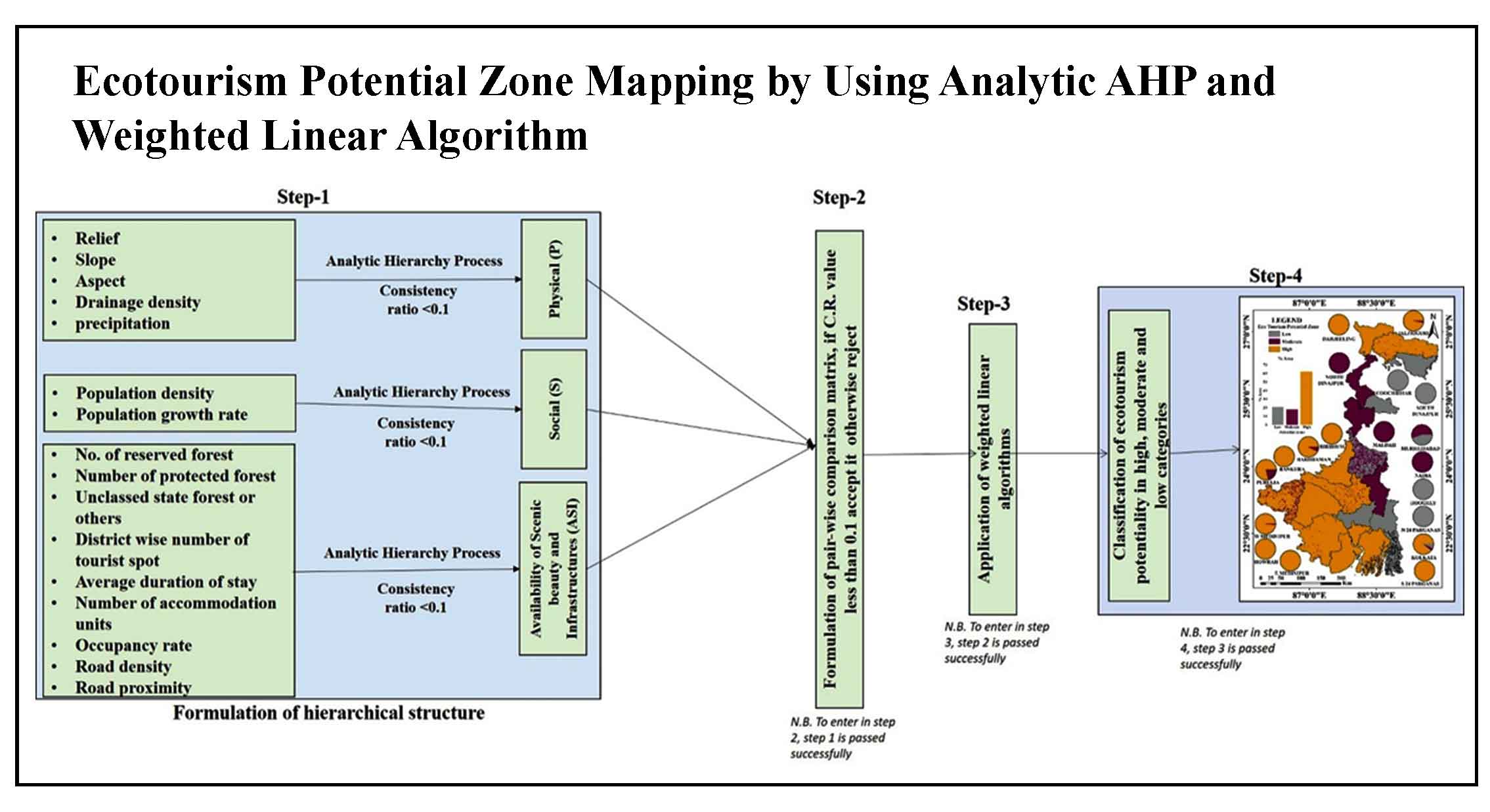
Article Title :
Analysis of Relationship between Vegetation Indices and Land Surface Temperature using GIS and Python in Middle Ganga Plain, India
2 (2018)
53-61
EVI , Ganga , LST , MODIS , NDVI , Python , Vegetation


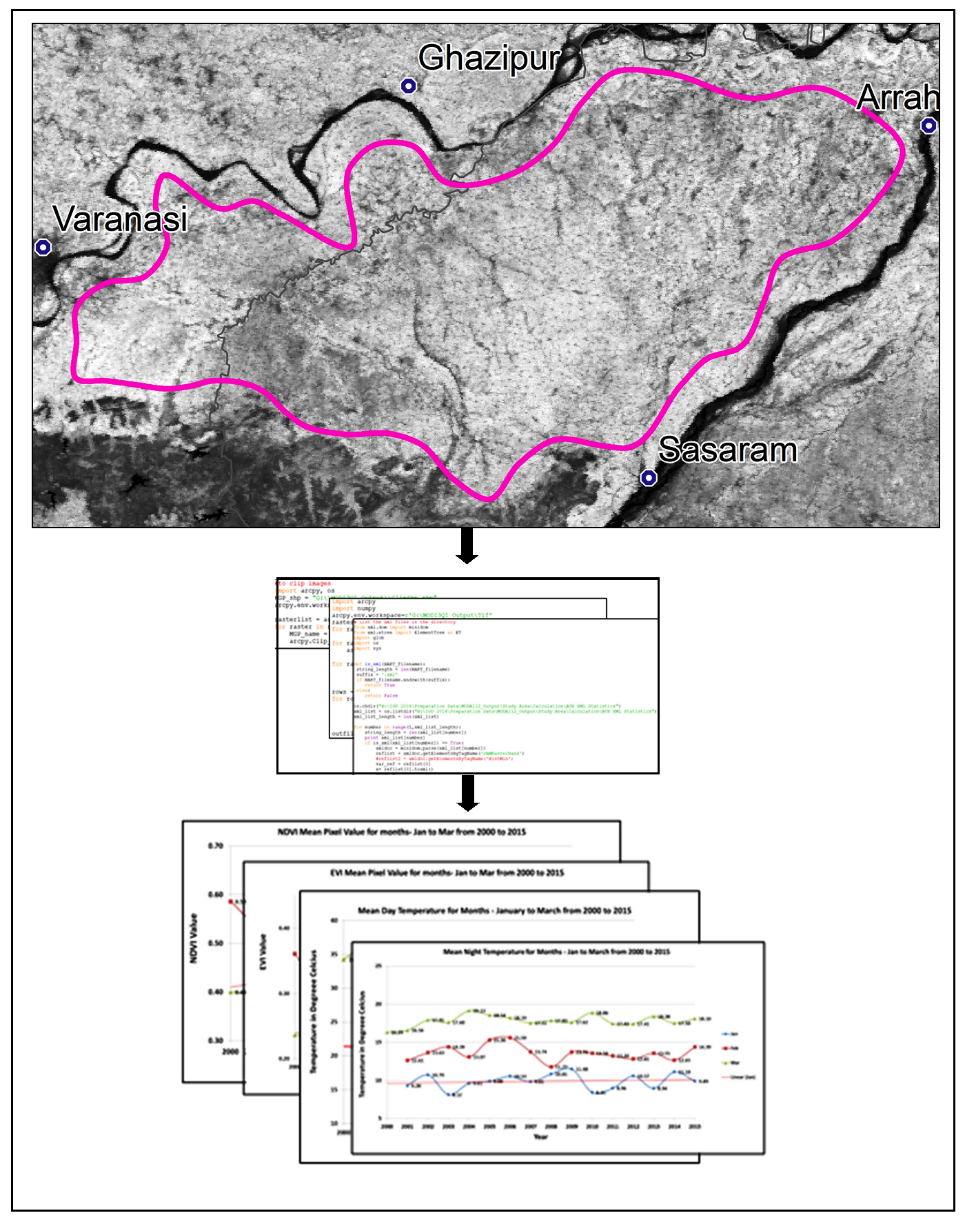
Global vegetation dynamics is a significant phenomenon being monitored from space. This study attempts to establish relationship among vegetation changes and land surface temperature using the data derived from satellite products in the Middle Ganga Plain, India using python programming. Ten years of MODIS Land Surface Temperature (LST) on board Terra, Normalized Difference Vegetation Index/Enhanced Vegetation Index (NDVI/EVI) (1km spatial and 8-days composite temporal resolution for LST and 250m spatial and 16-days composite for NDVI/EVI) has been used in this study. The average LST for the month of January was 23.0°C which fell to 15.7°C for the same month in 2015; whereas in March it was recorded to be 35.3°C and reduced to 32.3°C in 2015. Mean NDVI value has been recorded to be 0.44 in January 2000 which has slightly increased to reach 0.50 for the same month in 2015. For the month of September, it was recorded at 0.49 in 2000 and 0.52 for the same month in 2015. This paper attempts to analyze the spatio-temporal distribution and empirical relationship of vegetation cover and LST using Python.
Uninturrpted monitoring of LST and vegetation cover is one of the results of advancement in space technology.
MODIS is one of the key data providers of the earth surface with high temporal resolution for meaningful analysis.
MOD13Q1 (250m) and MOD11A2 (1000m) for 16 years (2000-2015) have been used for monitoring of vegetation and land surface temperature, respectively.
Python, programming language was used to retrieve and analysis of NDVI, EVI and LST from 1098 tiles of MODIS datasets.
Inverse relationship was observed between temperature and vegetation in the study area.
Friedl, M. A., McIver, D. K.; Hodges, J. C.F., Zhang, X. Y., Strahler, A. H., Woodcock, C. E., Gopal, S., Schneider, A., Cooper, A., Baccini, A., Gao, F., Schaaf, C., and Muchoney, D., 2002. Global land cover mapping from MODIS: Algorithms and early results. Remote Sensing of Environment, 83(1-2), 287-302.
Julien, Y., Sobrino, J. A., Mattar, C., Ruescas, A. B., Jiménez-Muñoz, J. C., Sòria, G., Hidalgo, V., Atitar, M., Franch, B. and Cuenca, J., 2011. Temporal analysis of normalized difference vegetation index (NDVI) and land surface temperature (LST) parameters to detect changes in the Iberian land cover between 1981 and 2001. International Journal of Remote Sensing, 32(7), 2057-2068.
Oguz, H., 2016. LST Calculator: A Python tool for retrieving land surface temperature from Landsat 8 imagery. Environmental Sustainability and Landscape Management, (March 2013), 560-572.